A team of Ahmedabad-based, Anant National University has developed a one-of-a-kind solution called the ‘automatic land, farm monitoring and plant protection system.’
Even today, farmers employ the same old way of placing scarecrows, but the end result is not optimal since scarecrows cannot restrict damage when anything happens in the centre of the field and cannot give live data on plants.
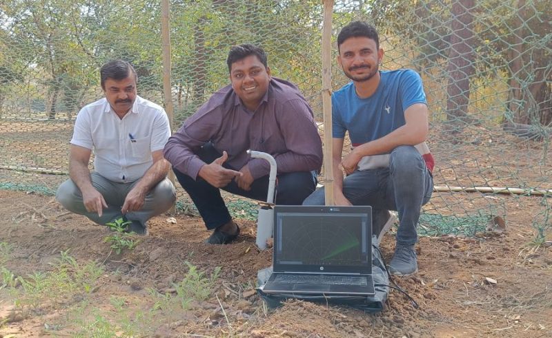
To address the age-old issue, the AnantU team, comprised of Parth Atulkumar Shah, Assistant Professor, Makerspace Manager along with lab technicians Girish Gajjar and Mayank Suthar, has developed and tested a smart farm monitoring and plant protection system that sends live data to any screen and also plays the role of the modern scarecrow. After deploying the hardware, the screen can be set at the farm’s entrance or attached to the guard cabin. The technology estimates the distance between a target item and its emitter by generating ultrasonic sound waves and converting the reflected sound into an electrical signal. The electrical signal data is mapped with processing code written in Java, and with the code, a UI is developed that displays live streaming and functions as a radar system like a defence radar.
You may also like to read: PM launches 100 Kisan Drones, promises constant support to startups
The system is linked with the servo motor metal gear to achieve mobility within a specified radius. The motor is adjusted at an angle ranging from 15 to 180 degrees over the appropriate range, and the lane layout is sufficient to monitor the region. The motor will spin the base, and a sensor pipe linked to the base will gather data. Furthermore, if the plant size is 3-4 feet, the developers have retained a possibility for expansion by adding an extra attachable pipe so that the plant development may be tracked accordingly. For the project, they utilised an open-source electronics platform based on simple hardware and software.
If the designated area scan by the sensor is green, then the plants and land are safe. If the lane scanning is done and finds red continually on screen, then there is some obstruction that is injuring the plant or land.