With world climate change and food shortages threatening the sustainability of our planet today, sustainable agriculture has become necessary than ever. Soil is important in the sustainability agenda, as it offers ecosystem services and a crop production platform. Techniques like remote sensing in agriculture are unique as they make estimating the state of the soil and other ecosystem services more effective and faster.
Remote Sensing in Agriculture
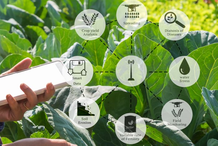
The use of remote sensing is an effective way to collect information on the characteristics of the soil without the need to collect field samples. Through satellites, drones, and other remote-sensing technologies, farmers and researchers can determine the soil condition as indicated through factors such as organic matter, moisture regimes, nutrients, and tillage activities.
Remote Sensing Techniques for Soil Health Assessment
1- Optical Remote Sensing
Optical remote sensing is the application of satellite images to gather information such as temperatures, plant moisture, growth of crops, and quality of the soil and land. In this technology, large areas of agriculture are viewed and the changes in soil health parameters over different periods can be evaluated.
2- Multispectral and Hyperspectral Imaging
Multispectral and hyperspectral imaging enables the method to capture spectral information of the ground and vegetation to identify nutrient content and moisture or stress conditions. This technique is widely useful for understanding the health of soil and the results of crops at the finest level.
You may also like to read – Thanos Technologies, IFFCO collaborate to advance agri practices in 10 lakh acres of farmland
3- LiDAR Technology
LiDAR (Light Detection and Ranging) is a measuring instrument where a laser pulse observes the terrain and its architecture. Together with other information obtained through remote sensing technologies, farmers as well as researchers for that matter, are in a position to develop soil property maps with improved accuracies and assess the dynamics of the soil with time.
Benefits of Remote Sensing in Soil Health Assessment
1-Large-scale detection of soil erosion and degradation
Remote sensing can assist in pinpointing the areas where soils are prone to degradation, enabling targeted conservation efforts.
2-Monitoring changes in vegetation health and land use practices
Remote sensing assists farmers and policymakers adapt to changing environmental conditions by tracking vegetative health, and land use patterns.
3-Areas at risk from nutrient deficiencies or pollution
This data generated by remote sensing can lead to early identification of nutrient deficiency or pollution hot spots that would then allow for proactive measures to be taken before these problems deteriorate further.
4-Enhancing water management and irrigation efficiency
By keeping an eye on water use as well as monitoring soil moisture status, remote sensing can optimise irrigation schemes thus reducing water wastage.
You may also like to read – Nuclear technologies offer unique tools to set science-based global food safety standards: FAO
Assessing Ecosystem Services Through Remote Sensing
Besides soil health, remote sensing techniques can be used for the assessment of ecosystem services for agricultural production landscapes. Various ecosystem services are vital in supporting agroecosystem resilience and productivity, namely pollination, water purification, carbon sequestration, and conservation of biodiversity.
Applications of Remote Sensing in Ecosystem Services Assessment
1-Pollination land and floral resources mapping
Remote sensing pinpoints places where there are suitable environments for pollinators and adequate floral resources, thus offering information for conservation purposes.
2-Tracking water quality and availability changes
Remote sensing helps in the adaptation of farmers and policymakers to changing environmental conditions by keeping a record of water quality and availability.
3-Evaluating carbon stocks and possibilities of sequestration
The use of remote sensing data can be employed as a tool to assess carbon sequestration capacity and determine rates of carbon stock change.
4-Identification of biodiversity hotspot areas and priorities on conservation action
Using remote sensing, ecological regions with high biodiversity levels can be identified leading to targeted conservation initiatives.
You may also like to read – AGCO invests in Innova Ag Innovation Fund to drive innovative & tech-oriented farming
Remote sensing is a valuable technique with the potential to enable the evaluation of soil quality and ecosystem services in sustainable agriculture. Farmers and policymakers can make informed decisions that will enhance future agricultural practices, preserve natural resources, and improve food security by using data and knowledge derived from this technology.
Let us therefore take up the inventive approaches presented by the remote sensors as we move towards a more durable and elastic agricultural future. It is important to remember that our actions impact life on Earth and hence, we should deploy the capabilities of remote sensing systems to support it.
(Dr. Sat Kumar Tomer is the founder & CEO of Satyukt Analytics. Views expressed in the article are author’s own.)


