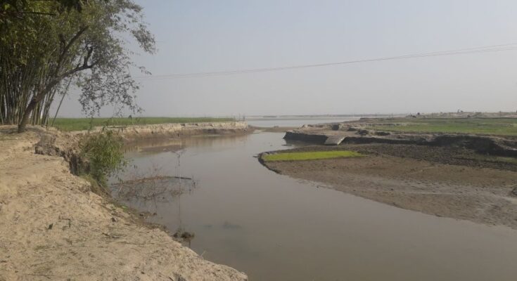
Irrigation and Waterways Department of West Bengal has mandated Noida based agritech company, Leads Connect Services for assessment and demarcation of flood-prone areas in the state using temporal satellite imageries to develop year-wise flood inundation maps from historical available data and images. In addition, the objective of the project is also to determine district-wise flood-prone area maps corresponding to different flood return periods. The project will be conducted in 23 districts of the state – Hawrah, Nadia, North 24 Praganas, South 24 Praganas among others for a duration of six months, starting from April 2022.
On bagging the project, Navneet Ravikar, Chairman & Managing Director, Leads Connect Services said, “The organisation is excited and fully prepared to deliver the project for assessment and demarcation of flood-prone areas of the state of West Bengal. West Bengal being the lowermost riparian state of Ganga-Brahmaputra basins, has both inter-state catchment areas (of 57,624 Sq. Kms.) and international catchment areas (of 34,252 Sq. Kms.), thus has no control over the influx from the upper catchment areas. The outfall tidal conditions often make the situation worse and river bank erosion, coastal erosion, waterlogging, tidal inundation, cyclones and depressions which are common phenomena of the state.”
“As the monsoon rainfall normally starts from June and ends in October, the districts in the southern parts of the state experience heavy precipitation, particularly in the months of September and October. Consequently, upon the development of low pressure/depressions in the Bay of Bengal during this period, major floods have been noticed to have occurred during this crucial period in 1978, 1984, 1991 and 2000. Through this assessment project, we intend to make indicative flood-prone area maps so that the situation in future doesn’t get worse and proactive measures can be taken,” Ravikar further said.
“The company is not only focussed on agritech but has been deeply involved in rigorous research and development activities on climate change and disaster management,” he added. He emphasized the need for a full-fledged and core research and development activities on various aspects of the earth system spanning from agriculture, climate change, and hazard analytics to disaster management. “Such a comprehensive assessment of the earth system may be helpful in understanding the impact of one component to another. This understanding may help in developing sustainable frameworks for the future,” Ravikar said.
You may also like to read: ICRISAT calls for applications from agritech startups under NIDHI-Seed Support Scheme
Prior bagging this project, the organization has worked with nodal agencies such as Mahalanobis National Crop Forecast Centre (MNCFC), Agriculture Insurance Company (AIC), and NABARD Consultancy Services (NABCONS) for research-based projects related to yield estimation, crop cutting experiments (CCE) and mapping agricultural infrastructures respectively.
Currently, Leads Connect is engaged in delivering projects in more than 100 districts of India and has a Pan-India presence backed by a comprehensive presence of a field team and a well-equipped research lab. The research lab of the company comprises interdisciplinary skill sets, and expertise spanning from agriculture, remote sensing, GIS, numerical modeling, data analytics and artificial intelligence.
Leads Connect has already been engaged in research and development activities pertaining to climate change and hazard analytics, disaster management, biodiversity analytics, landscape and urban analytics and health analytics, using cutting edge technologies such as satellite remote sensing analytics and machine learning and deep-tech intelligence since the year 2018. The company is in collaboration with the AIR Institute, Spain for studying the biophysical impacts of climate change in the North-East Region of India. It is also associated with Birla Institute of Technology (BIT), Mesra-Jharkhand for performing a study on assessing environmental dynamics of Jharkhand and subsequently for developing a machine learning (ML) model for construing intrinsic characteristics of environmental dynamics.


