AgriTech organisations are changing the face of agriculture every day with the use of modern technologies like the internet of things (IoT), blockchain, machine learning, GIS, artificial intelligence, GPS tagging, drones, satellite imagery, and many more. Agricultural satellite imagery is paving the way for new and efficient industry growth. It offers the opportunity to implement a data-driven approach and bring more precision to agricultural activities. Satellite images help make agricultural practices increasingly predictable and seamless.
Agriculture satellite imagery predicts weather conditions and provides accurate produce estimates, in turn, fortifying farm planning practices. The integration of the technology implementations like IoT devices, and deciding adequate agrochemical requirements can also aid in precision agriculture practices. Satellites and remote sensors have been created that monitor farms consistently and empower the farmers and agribusinesses to screen the data and receive real-time updates about the accurate time for harvest.
Making agricultural practices increasingly sustainable
Water management and employing sustainable agricultural practices have become imperative with the dark cloud of global warming looming over us. The prudent use of water can prove to be economic and additionally prevent under or over-irrigation. Water conservation and its proper utilisation can influence crop quality and productivity positively.
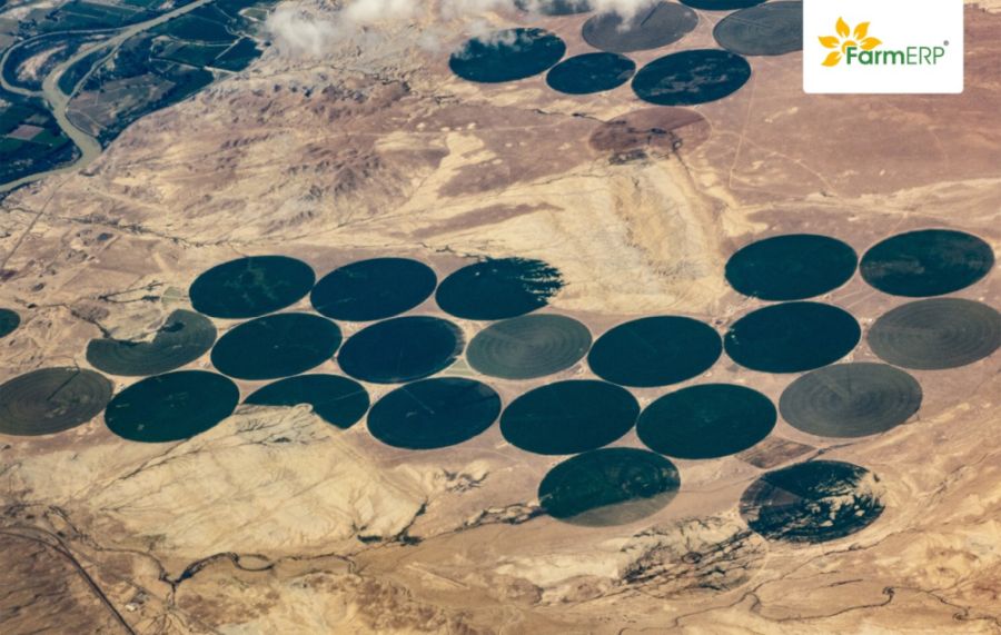
Agricultural remote sensing satellites assists farmers and agribusinesses to monitor large crop areas seamlessly. It provides estimates of water requirements and demands across the field which enables farmers and businesses to understand the required amount of water, in an optimum sense. This enables simplifying irrigation management and makes farm management efficient.
Satellite images and climate-resilience
Global warming has caused several calamities like famine, droughts, floods, sudden untimely rains to destroy crops. Prior knowledge of weather events can help farmers predict and prepare for such calamities. It aids them with the knowledge to make an informed decision and protect their crops.
Satellite imagery assists by monitoring climatic conditions and predicting climatic disasters. The use of satellite images and data could be useful in charting an efficient plan of action that mitigates the impact of weather events on agricultural practices. These make agriculture more sustainable and can save the farmers and agribusiness a lot of money.
Futuristic way of growing healthier crops
Pest infestations and crop diseases can be a major cause of concern for farmers and agribusinesses. Insecticides, fertilisers and pesticides are used by farmers to keep these yield-destroying pests at bay. One of the biggest mistakes the crop growers make is spraying the same amount of chemicals throughout the field. The requirement of each plot and crop may vary significantly. Over-spraying chemicals can impede the quality of crops and affect the nutritional value of the soil.
Satellite data can be utilised to determine accurate agrochemical requirements for specific parts of a field. This ensures that every crop is provided with the chemical that it requires and not more than that. This mitigates critical food security concerns and brings down crop failure incidents.
Satellite imagery aiding precision agriculture practices
Precision farming practices help in optimising the efficiency of the farm through intelligent resource utilisation. Agribusinesses can witness considerable savings on water usage, seeds, pesticides, and many other agricultural inputs owing to precision agriculture. Precision agriculture increases productivity and improves crop quality.
The satellite imagery-IoT integration involves the combination of high-resolution images with smart devices. Agricultural drones can utilise reliable crop information from satellite images to carry out the process of fertiliser spraying precisely. The seeding function can also be streamlined and made more precise by using agricultural robots in coordination with satellite images.
Driving innovative agricultural discoveries with advanced ERP
Agricultural research and development is an underestimated tool that promotes food security and improves farming practices and resilience. The insights provided by satellite imagery about various crops and other field parameters take agricultural practices one step ahead.
Agriculture satellite imagery can be a beneficial tool in agricultural R&D and give more insight into smart agriculture procedures that optimise productivity and reduce crop failure trends.
Satellite imagery allows yield estimations
Precise estimation of crop yields is of utmost importance for stakeholders that invest in agricultural practices. Farm management and planning can be streamlined through satellite imagery. It also promotes opportune decisions about agricultural produce.
The integration of agriculture satellite imagery with an ERP platform can simplify the detection of vegetation, moisture, micronutrient stress, among other similar issues. This can assist in making accurate estimates of yields. Agriculture satellite imagery can strengthen the procurement and storage plans of agribusinesses with crop-specific yield estimates. Moreover, these estimates can also assist insurance companies in determining future crop conditions efficiently. Satellite imagery in agriculture is an asset that can increase productivity, enable sustainable agricultural practices and cuts farming costs.
We live in a world that has been taken over by technology that simplifies day-to-day practices. The lack of knowledge and penetration of technology has postponed the technological revolution of the agriculture sector. With more and more stakeholders investing in agriculture and agribusinesses, the sector has become more executive and transparent.
(Views expressed in the article are author’s own.)


