Drone manufacturer IoTechWorld Avigation has recently joined hands with Switzerland-based company Pix4D which specialises in photogrammetry software technology to jointly offer precision farming solutions in the country, the drone manufacturer announced today.
Speaking about the tie-up between the two companies, Deepak Bhardwaj, Co-Founder and Director, IoTechWorld Avigation said, “We are witnessing an agri-drone revolution in the country and gradually we are moving towards precision farming. Our association is to foster awareness about drone-enabled crop health monitoring.”
Underlining the objective of the association, Anoop Upadhyay, Co-Founder and Director, IoTechWorld Avigation said, “Initially our approach involves the creation of awareness among industry, researchers, and academia. Subsequently, we will create awareness among farmers as well.”
You may also like to read: Digitisation in agriculture will bring in the next big green revolution, says G20 Sherpa Amitabh Kant
Expressing the rationale behind the association, Mitul Arora, Business Development Lead – India & South Asia, Pix4D said, “Everyone needs a customised and one-stop solution. IoTechWorld has drone technology and multi-spectral sensors by the name Sequoia and now they will have our photogrammetry technology too. So, through this association, a one-stop solution will be provided to all, and this will be beneficial for the govt research institutes, crop insurance and other associated specialised tasks.”
“India is undergoing a tremendous transformation in the agriculture sector and adoption of technology is happening at an unprecedented level. This opens an opportunity and this association is expected to enable faster and deeper integration of technology in various spheres of agriculture,” IoTechWorld said.
You may also like to read: FarmERP strengthens its agritech services by offering 8 new languages, including Spanish and French
Pix4D is recognised for its Pix4Dfields Software, a cutting-edge solution designed for advanced agricultural mapping. The software processes RGB and multispectral data for aerial crop analysis and digital farming. Pix4D has offices in seven countries across multiple continents meeting the requirements of these as well as neighbouring countries.
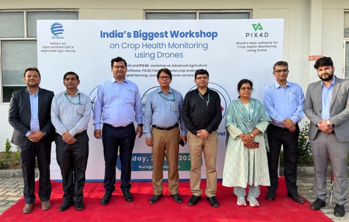
IoTechWorld and Pix4D collaboratively organised a workshop for crop health monitoring using drones,” with Cody Sokkappa of Pix4D Japan as the lead instructor. The event drew approximately 70 attendees, predominantly comprised of scientists from governmental institutions. Additionally, a cohort of researchers from esteemed crop protection firms, including Syngenta and BASF, also took part in the workshop.


